Commercial Roofing Services
Drone Roof Inspection in Nampa, ID
Drone imaging for large or hard-to-reach commercial roofs in Nampa, ID, with flight logs, overlapping photo sets, and follow-up checks on the roof itself.
Drone Roof Inspection
The flight log belongs in the file beside the photographs. It shows the date, the time of day, the sun angle, the wind, the altitude, and the pattern the aircraft flew, and without those facts a set of images cannot be compared with the next set. A drone makes a large roof visible in minutes, but the value of that visibility depends on how consistently the images are captured and how plainly the report separates what the images show from what only a roof walk can confirm.
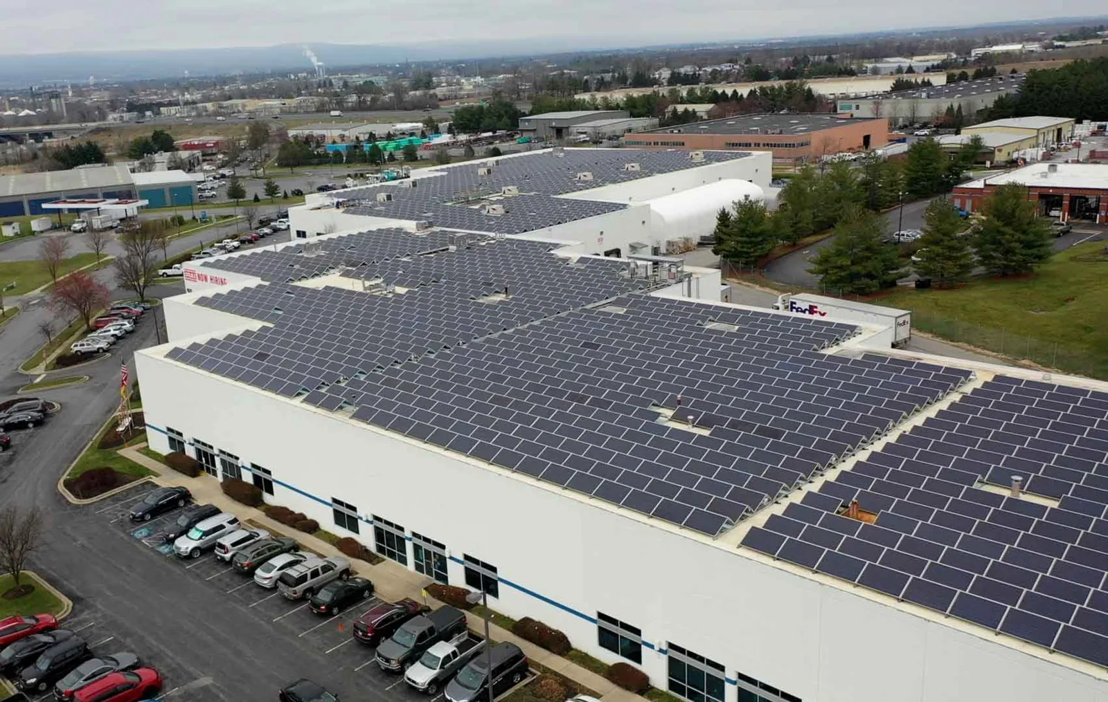
For commercial owners in Nampa, ID, drone imaging suits roofs that are large, high, fragile, or crowded with equipment, where foot traffic costs time or risks damage. It supplies a map of the roof surface, a set of close views of suspect areas, and a record that the owner can reshoot a year later from the same positions.
Flight Plan
Before launch, we confirm the building address, the roof sections, access to the take-off point, and any nearby obstacles such as stacks, antennas, power lines, and tall neighbors. Flights follow federal aviation rules, and where a site sits within controlled airspace the required authorization is requested before the flight, not after. The pilot checks wind speed and light, because gusts degrade the images and a low sun casts shadows that hide defects.
The flight itself is planned in two parts. A grid pass at constant altitude collects overlapping images of the whole roof, which can be assembled into a single map. A second pass collects oblique and close views of the edges, parapets, equipment curbs, and any area the grid pass flags. Both passes are logged, and the images carry location data so each can be placed on the roof plan.
Image Capture
Overlap is the key to a useful set: each frame shares enough area with its neighbors that the assembled map has no gaps. Close frames are taken at a consistent distance so a blister, a split, or a ponded area has a recognizable scale. Thermal imaging can be added when conditions suit it, such as a clear evening after a sunny day, and the thermal pass is treated as a screening tool whose findings are confirmed by moisture survey methods on the roof.
The images are named by roof section and grouped by pass. A reviewer can open the folder and see the full map first, then each section, then each flagged item, in the same order as the report. That structure turns a pile of photographs into a record that can be read in a few minutes by someone who was never on site.
What the Imagery Shows
Aerial images show surface conditions well: membrane discoloration, ponding stains, displaced ballast, torn edges, missing coping, debris at drains, rust at metal panels, and the layout of equipment and penetrations. They also show the roof as a whole, which a walk does not. Patterns that are invisible at ground level, such as a line of ponding that follows a structural grid or a row of stains below equipment, become obvious from altitude.
For a standing seam metal roof, images can show panel alignment, fastener staining, and the condition of laps and ridge caps. On a broad low-slope membrane, they show seam lines and the paths water takes toward drains. The report marks each finding with its location on the roof plan and its apparent severity, using careful wording such as visible staining or apparent separation.
What Still Needs a Roof Walk
Images cannot test a seam. They cannot tell whether a blister is dry or filled with water, whether insulation is wet, or whether a flashing is bonded or merely resting in place. The report therefore sorts findings into those the images confirm and those that need a hands-on check, and the second group becomes a short visit by an inspector with a probe, a meter, and a camera.
A low-slope roof of any size takes time to walk in full, and in northern Nampa, where the city plan describes industrial tracts and regional commercial properties near I-84, a first pass from the air can sort the roofs worth a long walk. The drone pass identifies the few areas worth a close walk, and the walk is spent on them instead of on the whole field. A traditional roof inspection remains the method for ratings and tests.
Large Roofs in the North and East
The city's North Nampa Industrial Area program targets investment and infrastructure, and the north quadrant plan lists activity near I-84 that includes retail, healthcare, and food processing. A drone survey suits an owner in the North Nampa Industrial Area who needs a baseline image set for a warehouse roof, or a manager along the Karcher Road corridor who wants to compare two buildings before choosing which to repair first.
The same method serves buildings that cannot easily be walked, such as roofs with fragile skylights, roofs under heavy equipment, or sections reached only by a ladder from a tenant space. Snow cover limits useful imaging, so the best flights fall between thaws, on dry days in the warm season or in clear winter windows after snow has cleared.
Deliverables
The deliverable set includes the assembled roof map, the annotated close images, the flight log, and a short written summary with a ranked list of areas for follow-up. The owner receives the original image files too, so a lender, an insurer, or a future contractor can use them. The set is formatted to attach to a condition report when the owner wants one.
Repeat flights are most useful when they use the same plan, the same season, and similar light. A yearly comparison shows ponding that is growing, seams that are opening, and damage that followed a storm, all without a roof crew.
A post-winter flight has a specific job. Nampa's criteria list a 20 psf ground snow load, and snowmelt that refroze at drains and edges leaves marks that show from above: staining at low spots, displaced coping, and debris pushed against parapets. Images taken in the first dry week of spring are compared with the autumn set, and the differences become the list of areas for a ground visit.
Questions
When is a drone better than walking the roof?
When the roof is large, high, fragile, or covered with equipment. The drone covers the full surface in minutes, and the walk is reserved for the areas the images flag.
Can a drone find wet insulation?
Not by itself. Thermal imaging can screen for it under the right conditions, but a moisture meter or core cut on the roof confirms the finding. The report separates screened areas from confirmed ones.
What weather stops a flight?
High wind, rain, low sun angles that cast long shadows, and snow cover all reduce image quality. The pilot logs the conditions and reflies if the set is not usable.
Do you need permission to fly over my building?
Federal aviation rules apply, and controlled airspace needs authorization before the flight. We also confirm the owner's consent, the take-off point, and any tenant restrictions at the property.
How do repeat flights help?
A repeat flight from the same plan shows change. Ponding that grows, seams that open, and damage after a storm all appear when two image sets are compared, which makes the next year's repair scope easier to write.